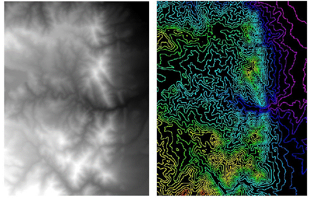
1.概述
遥感影像承载着丰富的地形、地物等方面的信息,是地学分析应用领域不可或缺的信息源。
Topographic
data are essential for studies of trafficability, route design, nonpoint source
pollution, intervisibility, siting of recreation areas, etc. Especially useful
are products derived from topographic data. These include:
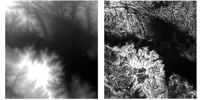
slope
images—illustrates changes in elevation over distance. Slope images are usuallycolor-coded according to the
steepness of the terrain at each pixel.
aspect
images—illustrates the prevailing direction that the slope faces at each pixel.
shaded relief
images—illustrates variations in terrain by differentiating areas that would be
illuminated or shadowed by a light source simulating the sun.
地形分析就是指在点、线、面高程基础上,对各种地形因素进行分析,并对图像进行地形校正。各种操作都是以DEM为基础的。
地形分析的用途:山区交通规划中计算最短路径和耗费最小路径;基于坡度、高程、坡向等计算积雪融化速率;求取野生动物栖息地;对地形敏感的影像分类。
2.高程图像数据生成
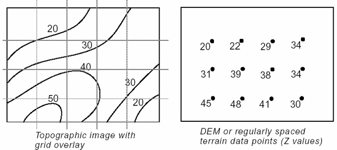
将ASCII码点文件、ArcInfo的coverage点文件和线文件等插值生成表面文件(surface)。ERDAS采用TIN插值,包括线性(一次多项式)插值和非线性(五次多项式)插值。
3.坡度分析(slope )
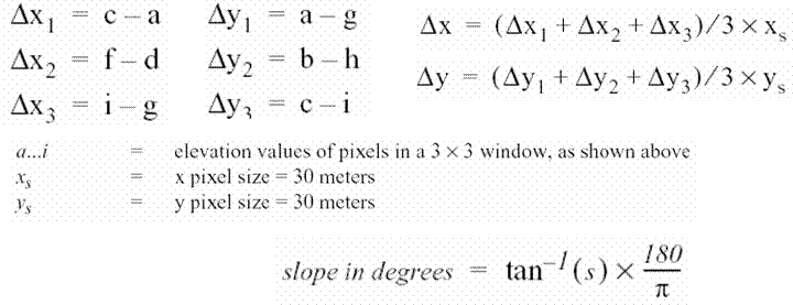
前提:DEM图像必须是具有投影地理坐标,而且其中高程数据及其单位是已知的。如果DEM图像中平面坐标为经纬度(角度)、而高程坐标为距离单位,坡度分析将无法进行。
4.坡向分析(aspect)
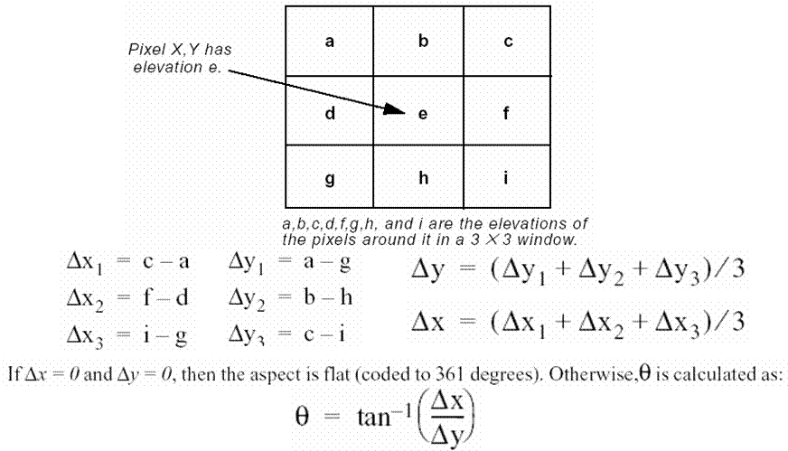
An aspect image is an image file that is gray scale coded according
to the prevailing direction of the slope at each pixel. Aspect is expressed in
degrees from north, clockwise, from 0 to 360.Due north is 0 degrees. A value of 90
degrees is due east, 180 degrees is due south, and 270 degrees is due west. A
value of 361 degrees is used to identify flat surfaces such as water bodies. Aspect
files are used in many of the same applications as slope files.In transportation planning, for example,
north facing slopes are often avoided. Especially in northern climates, these
would be exposed to the most severe weather and would hold snow and ice the
longest. It would be possible to recode all pixels with north facing aspects as
undesirable for road building.

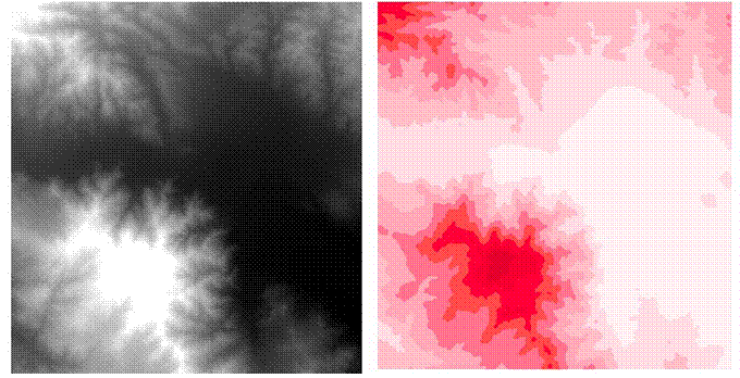
按照用户定义的分级表对DEM数据或其它图像数据进行分带(分类或分级),每个分带中的数据间隔相等。对于DEM数据,这种处理就是高程分带,而对于其它遥感图像,这种处理相当于进行专题分类(或分级)。
6.地形阴影(shaded relief)
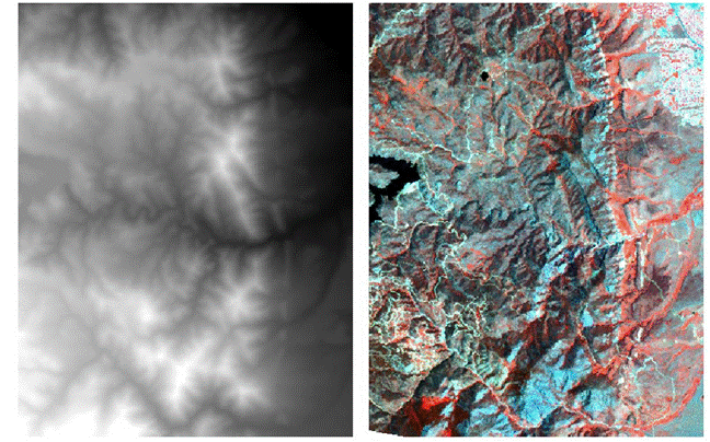
以DEM栅格数据为基础,在一定的光照条件下生成地形阴影图像(地势图)。如果需要在地形阴影图上叠加其它图像数据层,可以确定叠加图像,产生具有地形阴影的影像图。
7.地形校正处理(topographic normalize)
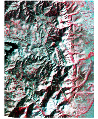
应用朗伯体或非朗伯体反射模型来消除地形对遥感图像的影响。太阳高度角和方位角参数信息通常包含在图像的头文件(header)中,可以在图像分发商那里获得。
8.栅格等高线(raster contour)
以DEM栅格数据为基础产生栅格等高线图。推而广之,如果输入图像是温度模型可以产生等温线,如果是数字环境模型,可以产生环境等值线等等。
